
Echoes of Collapse
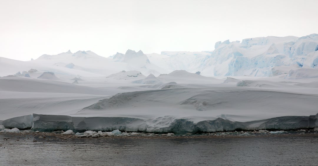
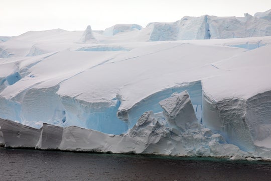
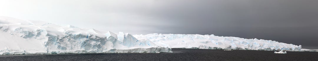
In March 2002, the Larsen B Ice Shelf broke apart in spectacular fashion, splintering into thousands of icebergs that spilled into the Weddell Sea on the east side of the Antarctic Peninsula. Covering an area nearly the size of Rhode Island, Larsen B’s disintegration was one of the most dramatic signs of rapid climate change yet observed. Scientists watched in shock as the 10,000-year-old platform of floating ice vanished in just a few weeks. The collapse raised urgent questions: What factors caused the rapid collapse of such an immense structure? And could this happen again?
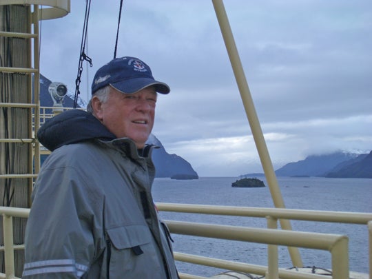
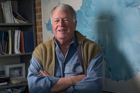
For John Anderson, a Rice professor emeritus of Earth, environmental and planetary sciences who devoted his career to uncovering Antarctica’s secrets, the Larsen B collapse was not an isolated event. It was the visible expression of processes he had spent four decades documenting. His research gave science the long memory it needed to understand an unfolding crisis.
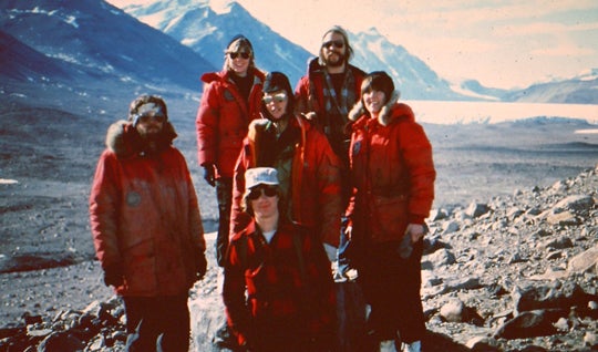
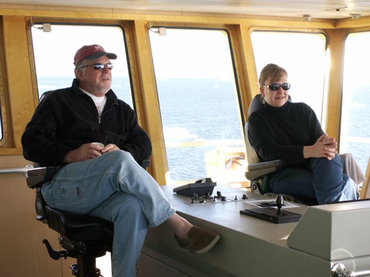
Anderson’s Antarctic story began almost by chance. “My first expedition to Antarctica was in 1970,” he said. “I had never contemplated going to Antarctica and knew virtually nothing about the continent.” In class one day, a professor announced that a research cruise was looking for a student. “Without a second thought, I threw my hand in the air and shouted, ‘I’ll go.’” That impulsive decision led to an extraordinary career that would ultimately include 24 trips and involve about 100 Rice students.
Anderson first arrived on the continent aboard a Coast Guard icebreaker during an exploratory era. Antarctica’s marine geology was largely a blank slate. “At the time, we knew virtually nothing about the ice sheet’s history,” he recalled. The only prior data had come from Shackleton’s 1915 expedition and the U.S. Navy’s Operation Highjump in the late 1940s. The 1970 mission focused on understanding the basic shape and characteristics of the ice sheet.
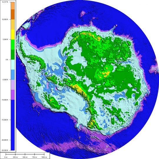
To understand the full scope of Anderson’s work, one must first understand the anatomy of the ice sheet itself. Thousands of feet thick, the ice sheet has been both larger and smaller during the five glacial-interglacial cycles Earth has undergone in the past 500,000 years. In each, ice has alternately grown and advanced seaward and melted and retreated landward.
While people typically think of continents as landmasses that rise above the sea, the margins of all continents, including Antarctica, extend well beyond their shores to include continental shelves — subsea aprons that are far shallower than the deep ocean abysses that mark the continental boundary.
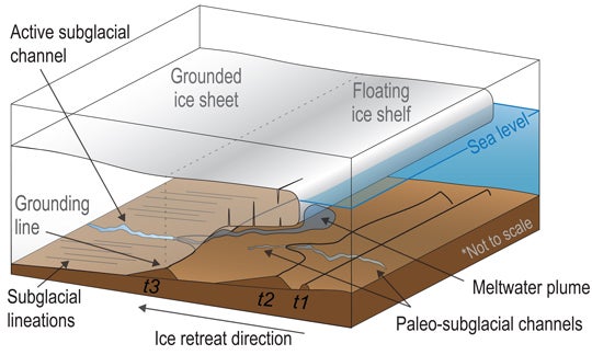
Under the Ross Sea in Western Antarctica, the continental shelf extends nearly 1,000 miles from the coast and is as much as 3,500 feet deep. The ice sheet rests on this shelf, and the grounding line is the crucial three-way boundary where ice, bedrock and seawater meet. The behavior of the grounding line controls the stability of the ice sheet. A retreating grounding line signals vulnerability; once it pulls back, collapse can accelerate.
Anderson’s initial objective was to collect sediment cores that could be used to study the ice sheet’s history, exploring the question of whether it had been significantly larger in the past, and, if so, by how much. On his first expeditions, he and his colleagues collected long cylinders of mud and sand from the seafloor, each a vertical record of Earth’s history. The cores captured evidence of how the ice sheet had advanced and retreated over tens of thousands of years.
Initially, technology limited what the cores could reveal. Radiocarbon dating of small carbonate samples wasn’t possible, so the precise timing of ice-sheet changes remained uncertain. But in 1979, Anderson’s team collected cores that could finally be dated. The results showed that the East Antarctic Ice Sheet had expanded across the deep inner shelf to the continent’s outer margins, then retreated inland. Even more striking, the timing of the advance and retreat coincided with ice-sheet shifts in the Northern Hemisphere, providing evidence that global climate systems were tightly linked.
Lauren Simkins, a former postdoctoral researcher in Anderson’s group, underscored the importance of this work. “We really need to understand how glaciers change on time scales of decades to hundreds to thousands of years to be able to understand what will happen in the future,” she said. “And really, the only way to do that is by interpreting data that comes from the geologic record.”
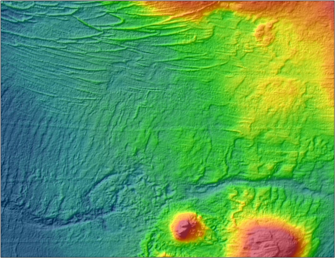
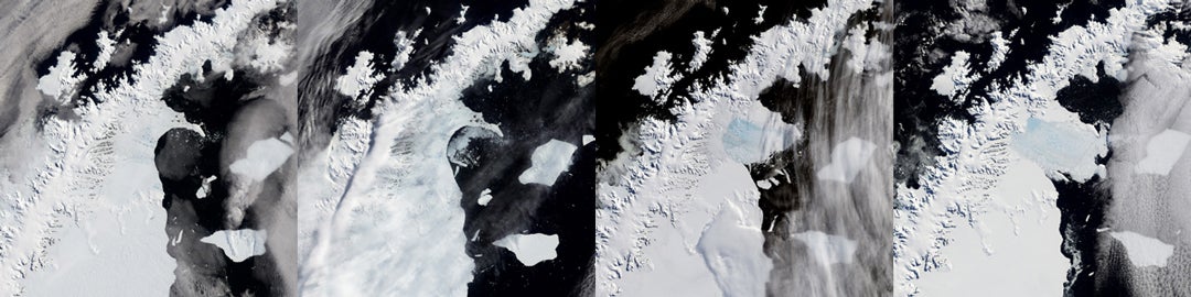
For years, sediment cores told only part of the story. While the cores provided a timeline, they couldn’t show the full, three-dimensional picture of the ice sheet’s past. In the 1990s, the field of Antarctic marine geology was transformed by a technological leap. Anderson’s group adopted a new technology, multibeam swath bathymetry. The system used many beams of sound waves simultaneously to map the seafloor in striking detail, revealing the landscape beneath the ice in a way never before possible.
The results were immediate and transformative. “Our first swath bathymetry images left no doubt that the ice sheet had advanced and retreated across the shelf,” Anderson said. For the first time, scientists could see landscapes carved by glaciers: streamlined ridges, deep troughs formed by the ice sheet as it expanded. Other images revealed features formed by the retreating ice sheet. These features provided irrefutable support to Anderson’s earlier hypotheses, proving that Antarctica’s ice sheet had collapsed repeatedly in the past.
In 1999, Anderson’s team mapped the Ross Sea and Pine Island Bay. “The data we collected included the first seafloor images of large subglacial channels, indicating that large amounts of meltwater had flowed from beneath the ice sheet during the last glacial maximum,” he noted. They also acquired the first radiocarbon-dated history of retreat from Pine Island Bay.
The new perspective allowed Anderson’s group to connect the timing and composition information from their sediment cores with seafloor maps that showed the sheer scale of glacial change. “It’s a big seascape that’s telling us a huge amount about where the ice was grounded and how it retreated,” Anderson said. “And what we’re finding is that in some areas it retreated pretty slowly and in other areas, it retreated remarkably fast.”
The more his team mapped, the clearer the picture became: Antarctica’s grounding lines were far from stable.
In Pine Island Bay, Anderson’s group discovered corrugations on the seafloor — ridges that recorded the ice lifting and dropping with each tidal cycle. “It’s being lifted and lowered by one-meter tidal oscillations,” he explained. “That’s telling us ‘Wow! That’s a really unstable grounding line.’”
He noted that the evidence then shifts from these tidal oscillations to “huge gouges in the seafloor that are formed by the ice breaking up and producing these enormous icebergs.” This represented a catastrophic breakup and a potentially rapid rise in sea level.
Oceanographic data added another piece. A tongue of warm, deep water was flowing across the shelf, melting the ice from below. This mechanism can trigger rapid collapses and is now recognized as one of the greatest threats to Antarctic stability.
“Our work has demonstrated convincingly to most people that the Antarctic ice sheet is, as predicted 40 years ago, quite unstable,” Anderson said. “The marine portions of the ice sheet are susceptible to rapid grounding line retreat. It’s happened many times in the past, in many locations and for different reasons.”
Simkins added a critical perspective on the value of this historic evidence. “We know these processes, these changes are happening today. But the nice thing about history is that it’s already happened, and we can figure out what caused those events to happen,” she said. “We know that some things are changing now, but we don’t know what the outcomes will be. For the past, we already have those outcomes.”
Anderson’s research not only helped scientists understand events in Antarctica, it provided a critical link to understanding the impacts of climate change on a global scale. This is especially true for coastal communities like Houston.
“It turns out the Texas shelf is probably one of the best places in the world to look for a geological record of these rapid sea level events,” he explained. The shelf’s shallow gradient and high sedimentation rates preserved evidence of rapid, punctuated sea-level rise events, which his group connected to Antarctic ice-sheet collapse.
The implications were sobering. What happens at the poles could reshape Texas’ coastline and threaten homes, industries and ecosystems where people actually live. Looking at NOAA’s Sea Level Rise Viewer, Anderson bluntly concluded that the Texas coast will change dramatically with just the one foot of sea-level rise predicted for the year 2050. For a Houston-based researcher, this connection tied the fate of distant ice sheets directly to his university’s own backyard.
The collapse of Larsen B was a dramatic spectacle, but Anderson’s career reminds us that its true meaning lies in the longer view. His belief in the critical role of climate change in driving these events long preceded widespread acceptance. He points to a prediction made in 1978 by scientist John Mercer, who, given models for greenhouse gases and warming, predicted that the Antarctic ice sheet would experience severe instabilities by 2028. “I always admired him for being the first person who was courageous enough to come out in a scientific article and make a statement like that, and it proved to be true,” Anderson said.
His career has gone from a time when there was little concern about Antarctic ice sheet stability to today’s talk of the “doomsday glacier.” “We’ve come full circle now,” he said. Even in their earliest efforts, Anderson and his colleagues knew there was enough ice in Antarctica to raise sea level by 180 feet if it all melted. He dedicated his career to building the scientific foundation to help humanity understand this immense threat.
Anderson’s scientific achievements are matched by his role as a mentor. Over nearly five decades, Rice University maintained continuous NSF support for its Antarctic program. Alongside landmark discoveries, the program trained generations of students who now lead research at institutions across the country and abroad.
Simkins, now an assistant professor at the University of Virginia, is one of many former students and postdocs carrying forward his influence. “There’s really a strong legacy of John’s mentorship in Antarctic science that is still felt today across a couple of generations of people,” she said. “Really good science can be done without having that competitive nature to it. That’s something I learned from him and carry with me.”
Anderson's work continues to inform the global community. Today, as warming oceans erode the base of glaciers like the Thwaites Glacier, which is considered the single largest potential contributor to future sea-level rise, his reconstructions serve as both a warning and a guide. His decades of persistence in uncovering Antarctica’s past have given the world a powerful tool to confront what comes next.
— Sage Lee ’26 and Lauren Kapcha
This work was made possible with support from the Fondren Fellows program.